
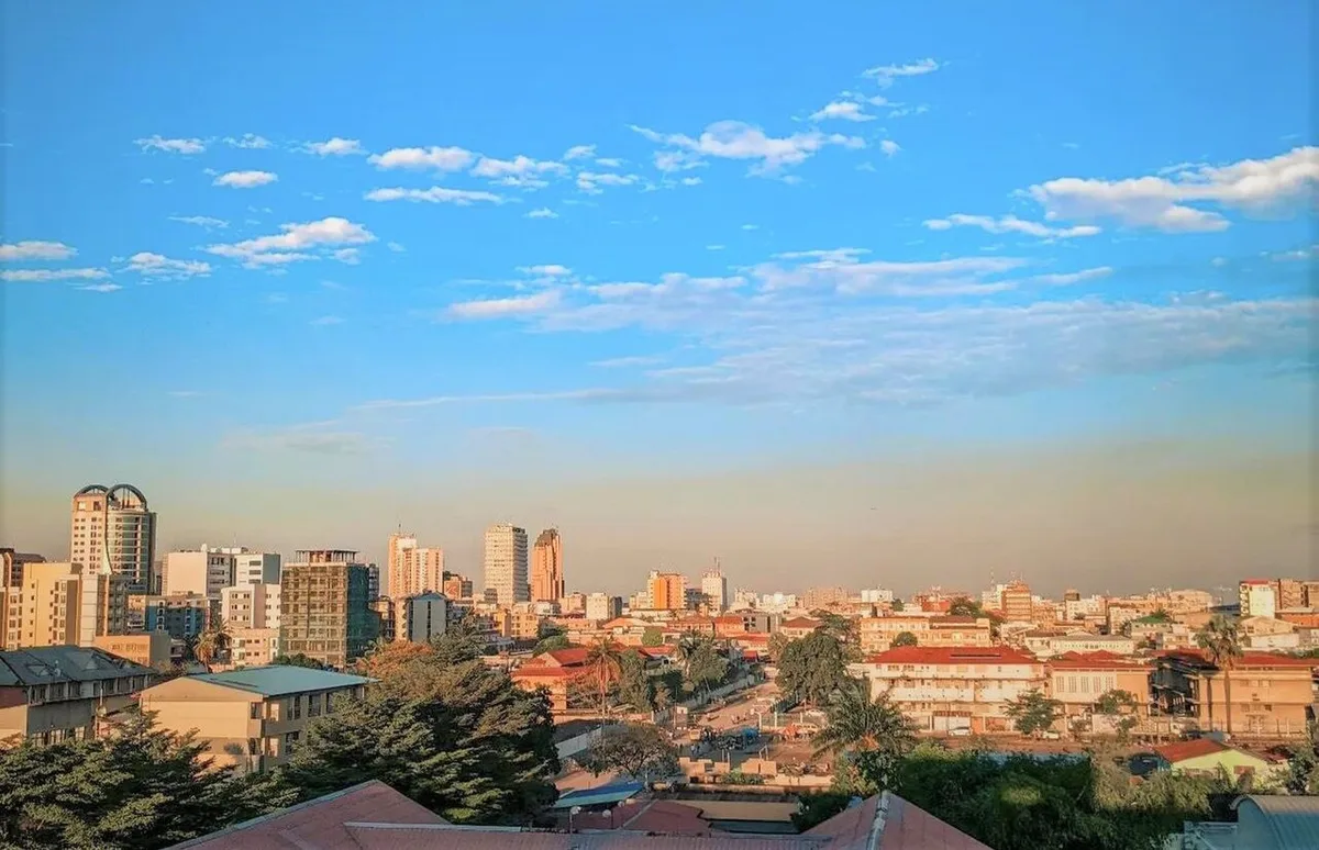
Kinshasa (; French: [kinʃasa]; Lingala: Kinsásá), formerly named Léopoldville (Dutch: Leopoldstad) from 1881 to 1966, is the capital and largest city of the Democratic Republic of the Congo. Kinshasa is one of the world's fastest-growing megacities, with an estimated population of 18.5 million in 2026. It is the most densely populated city in the DRC, the third-most populous city and third-largest metropolitan area in Africa, the world's seventh-most populous city proper (the most populous outside of China), and the fourth-most populous capital city in the world. It is the leading economic, political, and cultural center of the DRC, housing several industries including manufacturing, telecommunications, banking, and entertainment. The city also hosts some of the DRC's significant institutional buildings, such as the People's Palace, Palace of the Nation, Constitutional Court, Court of Cassation, Council of State, African Union City, Marble Palace, Government House, Kinshasa Financial Center, and other national departments and agencies.
The Kinshasa site has been inhabited by Teke and Humbu people for centuries and was known as Nshasa before transforming into a commercial hub during the 19th and 20th centuries. The city was named Léopoldville by Henry Morton Stanley in honor of Leopold II of Belgium. The name was changed to Kinshasa in 1966 during Mobutu Sese Seko's Zairianisation campaign as a tribute to Nshasa village. Covering 9,965 square kilometers, Kinshasa stretches along the southern shores of the Pool Malebo on the Congo River. It forms an expansive crescent across flat, low-lying terrain at an average altitude of about 300 meters. Kinshasa borders the Mai-Ndombe, Kwilu, and Kwango Provinces to the east; the Congo River delineates its western and northern perimeters, constituting a natural border with the Republic of the Congo; to the south lies the Kongo Central Province. Across the river sits Brazzaville, the smaller capital of the neighboring Republic of the Congo, forming the world's closest pair of capital cities despite being separated by a four-kilometer-wide unbridged span of the Congo River.
Kinshasa also functions as one of the 26 provinces of the Democratic Republic of the Congo; it is administratively divided into 24 communes, which are further subdivided into 365 quarters. With an expansive administrative region, over 90 percent of the province's land remains rural, while urban growth predominantly occurs on its western side. Kinshasa is the largest nominally Francophone urban area globally, with French being the language of government, education, media, public services and high-end commerce, while Lingala is used as a lingua franca in the street. The city's inhabitants are popularly known as Kinois, with the term "Kinshasans" used in English terminology.
The National Museum of the Democratic Republic of the Congo is the DRC's most prominent and central museum. The College of Advanced Studies in Strategy and Defense is the highest military institution in the DRC. The National Pedagogical University is the DRC's first pedagogical university. N'Djili International Airport is the largest airport in the nation. In 2015, Kinshasa was designated as a City of Music by UNESCO and has been a member of the Creative Cities Network since then. Nsele Valley Park is the largest urban park in Kinshasa. According to the 2016 annual ranking, Kinshasa is Africa's most expensive city for expatriate employees, ahead of close to 200 global locations.
Contents
Toponymy
There are several theories about the origin of the name Kinshasa. Paul Raymaekers, an anthropologist and ethnologist, suggests that the name derives from the combination of the Kikongo and Kihumbu languages. The prefix "Ki(n)" signifies a hill or inhabited area and "Nsasa" or "Nshasa" refers to a bag of salt. According to Raymackers, Kinshasa was a significant trading site where people from the Lower Congo (now Kongo Central Province) and South Atlantic Ocean exchanged salt for goods such as iron, slaves and ivory brought by those from the Upper Congo (now Tshopo Province). However, Hendrik van Moorsel, an anthropologist, historian and researcher, proposes that Bateke fishermen traded fish for cassava with locals along the riverbank, and the place of this exchange was called "Ulio". In Teke, "exchange" is "Utsaya", and "place of exchange" is "Intsaya". Thus, the name evolved from Ulio to Intsaya, and later, under the influence of Kikongo, transformed into Kintsaya, eventually becoming Kinshasa. Kinshasa, also known as N'shasa, is regarded as the primary "place of exchange" on the southern bank of the Pool Malebo, where bartering occurred even before the commercial boom of Kintambo.
The name Nshasa is believed to originate from the Teke verb "tsaya" (tsaa), meaning "to exchange", and the noun "intsaya" (insaa), referring to any market or place of exchange. It was at this location that Teke brokers traded ivory and slaves from the Banunu slave traders, often mistaken for the Yanzi, for European trade items brought by the Zombo and Kongo people. Despite the various theories, the historical name of Kinshasa is known to have been Nshasa, as documented by Henry Morton Stanley during his crossing of Africa from Zanzibar to Boma in 1874–1877 when he mentioned visiting "the king of Nshasa" on 14 March 1877.
History
In pre-colonial times, the area was inhabited by two trading centres, Ntamo and Ntsaasa, which were part of the Tio Kingdom.
The city was established as a trading post by Henry Morton Stanley in 1881. It was named Léopoldville in honor of Stanley's employer King Leopold II of the Belgians. He would then proceed to take control of most of the Congo Basin as the Congo Free State, not as a colony but as his private property. The post flourished as the first navigable port on the Congo River above Livingstone Falls, a series of rapids over 300 kilometres (190 miles) below Leopoldville. At first, all goods arriving by sea or being sent by sea had to be carried by porters between Léopoldville and Matadi, the port below the rapids and 150 km (93 mi) from the coast. The completion of the Matadi–Kinshasa portage railway, in 1898, provided an alternative route around the rapids and sparked the rapid development of Léopoldville. In 1914, a pipeline was installed so that crude oil could be transported from Matadi to the upriver steamers in Leopoldville. By 1923, the city was elevated to capital of the Belgian Congo, replacing the town of Boma in the Congo estuary, pursuant to the Royal Decree of 1 July 1923, countersigned by the Minister of the Colonies, Louis Franc. This transition, finalized on 31 October 1929, led to the development of a new administrative quartier located between Kinshasa, then emerging as a major commercial center, and Léopoldville-West, a preexisting settlement. The selected site was named Kalina (now Gombe) and developed as the colonial administrative center. Before this, Léopoldville was designated an "urban district", encompassing exclusively the communes of Kintambo and the current Gombe, which burgeoned around Ngaliema Bay. Then the communes of Kinshasa, Barumbu, and Lingwala emerged. In the 1930s, these communes predominantly housed employees of Chanic, Filtisaf, and Utex Africa.
In 1941, legislative ordinance n°293/AIMO of 25 June 1941, conferred Kinshasa the status of a city and established an Urban Committee (Comité Urbain), with an allocated area of 5,000 hectares and a population of 53,000. Concurrently, it became the colony's capital, the Congo-Kasaï Province's capital, and the Moyen Congo district. The city was demarcated into two zones: the urban zone, comprising Léo II, Léo-Ouest, Kalina, Léo-I, or Léo-Est, and Ndolo; and the indigenous zone to the south. The urban populace swelled in 1945 with the cessation of forced labor, facilitating the influx of native Africans from rural regions. Léopoldville then became predominantly inhabited by the Bakongo ethnic group.
Urban history
European urban development began in 1881 and was guided by rigid planning principles to preserved an orderly and aesthetically pleasing environment. A major urban expansion was the construction of the Matadi–Léopoldville Railway, which was initiated in 1890 and completed in 1911. The project was emblematic of colonial progress and served as a critical link between the port of Léopoldville and the coastal city of Matadi. After its completion, the station began to transform, with the erection of prefabricated residences known as "Danish houses", which were imported from Belgium. These permanent structures gradually replaced the temporary tents that had accommodated early explorers, soldiers, and mercenaries. As Léopoldville developed into an administrative and military center, agents of the Congo Free State, and, after 1908, those of the Belgian Congo, settled in the area. Europeans often worked as engineers, architects, carpenters, and builders, and were supported by mercenaries and trained African laborers, who were instrumental in the physical construction. By 1902, the Kitambo (now Kintambo) area was entirely occupied by European constructions. The urban center expanded as surrounding villages grew, drawn by the prospects of employment and commerce. These settlements would eventually constitute the earliest cités indigènes, which were designated residential areas for the African population.
At this early stage, the connection between Léopoldville (commonly referred to as "Léo") and Kinshasa consisted of an eight-kilometer track that was often impassable during the rainy season. Transportation was rudimentary, with a few bicycles, limited private cars, and even dromedaries in use, as public transit infrastructure was virtually nonexistent. In 1911, George Moulaert, an influential colonial administrator, drafted a comprehensive urban plan for Léopoldville and the greater Kinshasa area that would guide spatial development for decades, while World War I accelerated local economic activity. Largely cut off from Europe, the Belgian Congo experienced a period of relative prosperity in which motorboats and trucks increasingly replaced traditional transport such as canoes and human porters, and by the end of the war in 1918 Léopoldville rivaled other Congolese cities and seized the attention of Belgian architects who saw it as a potential model for colonial urban experimentation. Colonial urbanization remained tightly controlled and reflected the aspirations and limitations of Belgian policy, and in 1922 a decree mandated that large companies provide housing for their African workers, a requirement that major firms such as Huileries du Congo Belge (HCB) met by building workers' camps, while smaller enterprises often failed to comply. The existing framework, governed by the decree on "the labor contract between natives and civilized masters", proved insufficient to meet growing housing demands, which then prompted religious missions to extend loans to African residents for self-construction before becoming overwhelmed, after which a special fund was established to provide interest-free loans for house construction using locally available materials.
Unrest in 1991 and the First Congo War
In 1991 the city had to fend off rioting soldiers, who were protesting the government's failure to pay them. Subsequently a rebel uprising began, which in 1997 finally brought down the regime of Mobutu.
The eruption of the First Congo War (1996–1997), closely tied to the aftermath of the 1994 Rwandan genocide, significantly intensified instability in Kinshasa and across the broader region. Following the genocide, the Rwandan Patriotic Front (RPF), under Paul Kagame, launched military operations into eastern Zaire, not only targeting Hutu insurgents but also committing large-scale violence against Hutu civilians. UNHCR consultant Robert Gersony estimated that between 5,000 and 10,000 people were killed monthly in mid-1994 alone. The influx of over two million Rwandan Hutu refugees into eastern Zaire further exacerbated security and humanitarian tensions, particularly in provinces such as South Kivu. President Mobutu's regime proved incapable of managing the crisis, thus facilitating the conditions for war. By 1996, foreign-backed militias, including the Rwandan Patriotic Army (RPA), the Ugandan People's Defence Force (UPDF), and Burundi's Forces Armées Burundaises (FAB), began supporting Congolese Tutsi groups such as the Banyamulenge. Belgian legal and political scholar Filip Reyntjens describes the First Congo War as the convergence of two overlapping goals: the genuine resistance of Congolese Tutsi, who feared retaliation, and the strategic use of this resistance by the Rwandan government to justify the RPA's military involvement in Zaire.
The fall of Kinshasa in May 1997 to the Rwandan- and Ugandan-backed Alliance des Forces Démocratiques pour la Libération du Congo (AFDL), led by Laurent-Désiré Kabila, was followed by widespread human rights abuses. AFDL and RPA forces carried out extrajudicial killings, acts of torture, rape, and targeted former regime officials as well as members of the elite Special Presidential Division (DSP). Between 18 and 22 May 1997, volunteer teams from the Congolese Red Cross collected between 228 and 318 bodies in Kinshasa and its outskirts and evacuated wounded civilians to local medical facilities. Reports from the United Nations Special Rapporteur and the United Nations Mapping Team indicate that the security situation deteriorated further between May and June 1997. During this period, AFDL and RPA units, often with the participation of civilians, carried out public executions, frequently incinerating the bodies in neighborhoods such as Masina, Matete, and Kingabwa (Limete commune). At the GLM (Groupe Litho Moboti) building, detainees, many of them former members of the Zairean Armed Forces (Forces Armées Zaïroises; FAZ) or political opponents, were routinely executed and their bodies discarded in the Congo River, a practice halted only after intervention by human rights advocates alerted by local fishermen. In September 1997, the security crisis in Kinshasa was compounded by cross-border shelling from Brazzaville. Armed factions involved in a separate conflict in Brazzaville launched artillery fire into Kinshasa between 29 September and 1 October, killing at least 21 civilians. In retaliation, FAC and RPA forces shelled Brazzaville for two consecutive days.
Second Congo War
The Second Congo War also plunged Kinshasa into a period of insecurity and military conflict after a dramatic breakdown in relations between President Laurent-Désiré Kabila and his former allies in Rwanda and Uganda, whom Kabila accused of undermining Congolese sovereignty and holding ambitions to carry out a coup d'état. Allegations also surfaced that the United States had provided indirect support to Rwanda during this period, including claims of military training by the Rwanda Interagency Assessment Team (RIAT), ostensibly to secure access to the DRC's vast mineral wealth. American individuals and institutions, such as Roger Winter of the U.S. Committee for Refugees and Immigrants, were further implicated in allegedly abetting insurgent activities. In response to these tensions, President Kabila dismissed Rwandan General James Kabarebe from his position as Chief of Staff and demanded the withdrawal of all Rwandan military personnel from Congolese territory. This move provoked a swift counteroffensive, as Rwanda and Uganda backed the formation of a new rebel group, the Rassemblement Congolais pour la Démocratie (RCD), which launched its rebellion from the city of Goma on 2 August 1998. The insurrection was spearheaded by mutinous units within the Congolese armed forces in coordination with Rwandan, Ugandan, and Burundian troops. Within weeks, RCD forces had captured large swathes of territory in the eastern and northern parts of the country, including regions of North and South Kivu, Orientale Province, North Katanga, and Équateur Province. Their advance toward Kinshasa and the western province of Bas-Congo was halted by military intervention from Angola and Zimbabwe, both of which deployed troops in support of Kabila's government.
This escalation led to the effective partition of the DRC, as Kabila's administration, reinforced by military contingents from Angola, Zimbabwe, Namibia, Chad, and Sudan, retained authority over the western and central regions. Conversely, the eastern part of the country fell under the control of the RCD's military wing, the Armée Nationale Congolaise (ANC), which was supported by Rwandan, Ugandan, and Burundian forces. In response, Kabila aligned with a range of non-state actors and militias, notably the Mayi-Mayi as well as Rwandan and Burundian Hutu rebel groups including the Forces pour la Défense de la Démocratie (FDD) and the Armée de Libération du Rwanda (ALiR), the latter composed in part of former members of the Rwandan Armed Forces and the Interahamwe militia. Uganda, while occupying substantial portions of Orientale Province, simultaneously sponsored the establishment of the Mouvement pour la Libération du Congo (MLC), under the leadership of Jean-Pierre Bemba, to administer the Ugandan-controlled regions of Équateur. Diverging strategic interests between Uganda and Rwanda eventually led to a split within the RCD itself, giving rise to two rival factions: the Rwanda-aligned RCD–Goma and the Uganda-supported RCD–ML. Despite their military superiority, these rebel coalitions faced persistent challenges in exerting full administrative and security control over rural areas, where they were met with sustained resistance from local militias, interethnic hostility, and community mistrust.
Geography
Location
Kinshasa is strategically situated on the southern bank of the expansive Malebo Pool, which covers 9,965 square kilometers in a broad crescent shape over flat, low-lying terrain with an average elevation of about 300 meters. It is bordered to the east by the provinces of Mai-Ndombe, Kwilu, and Kwango, to the south by Kongo Central, and to the north and west by the Congo River, which forms the natural boundary with the Republic of the Congo.
The Congo River, Africa's second-longest river after the Nile, has the continent's highest discharge and serves as a critical transportation route across much of the Congo Basin, with river barges navigable between Kinshasa and Kisangani and along several tributaries. It is also a significant source of hydroelectric power, with the potential downstream of Kinshasa to generate electricity sufficient for roughly half of Africa's population.
Relief
Topographically, Kinshasa has a marshy, alluvial plain, with altitudes ranging from 275 to 300 meters, along with hilly terrain that elevates from 310 to 370 meters. It has four principal features: the Malebo Pool, a large water body with islands and islets; the Kinshasa Plain, a highly urbanizable area prone to drainage problems; the terrace, a series of low ridges overlooking the plain; and the hills area, marked by deep valleys and cirque-shaped formations.
The Malebo Pool extends roughly 35 kilometers long and 25 kilometers wide, bordered by Ngaliema in the west and Maluku in the east, and passes through other communes including Gombe, Barumbu, Limete, Masina, and Nsele. The Kinshasa Plain has a banana-like shape and is surrounded by eastward-oriented hills. Comprising mainly sandy alluvial deposits, this plain covers an area of about 20,000 hectares and hosts some of the city's most densely populated and urbanized communes, such as Limete, Kalamu, Bandalungwa, Ngiri-Ngiri, Kinshasa, Barumbu, and Lingwala. Despite its urban potential, the plain is highly vulnerable to seasonal flooding and waterlogging due to inadequate drainage infrastructure, with recurrent inundation occurring during the rainy season.
The terrace is mainly situated in the city's western expanse, between N'djili and Mont-Ngafula. It comprises stony blocks of soft sandstone and silica-covered yellow clay, topped with brown silt, and ranges from 10 to 25 meters in height. It retains vestiges of an ancient surface. The hills area commences several kilometers from the Malebo Pool and is characterized by deep valleys and cirque-shaped formations. These hills reach heights surpassing 700 meters and exhibit gentle, rounded contours sculpted by local rivers. While their eastern counterparts may reflect remnants of the Batéké Plateau, their origins in the west and south remain enigmatic. This region forms a natural amphitheater shaped by river erosion processes, which have been exacerbated by anthropogenic activities, often resulting in significant environmental degradation. Communes located within or adjacent to these hilly areas include Mont-Ngafula, Bumbu, Selembao, Kisenso, and Ngaliema. In addition, Makala and Ngaba, although partially located within the plains, gradually ascend into the adjacent highlands.
Hydrography
Kinshasa's hydrographic landscape is defined by an intricate and predominantly dendritic network of rivers and valleys that converge toward Pool Malebo. This fluvial system, which predominantly flows from the southern and southwestern highlands toward the north and northeast, is shaped by the region's topographical gradient and its underlying lithological structure. The city's current hydrological dynamics are the cumulative result of long-term tectonic shifts, sedimentary processes, and climatic variability that have defined the development of river systems over geological time scales.
The hydrographic system is composed of two main categories of rivers: allochthonous (originating outside the city) and autochthonous (local or internal to the city). The allochthonous rivers, which include the N'djili, N'sele, and the Pool Malebo, form the city's eastern and northern boundaries. These rivers have their sources far beyond the city's southern hills and generally flow in a south-to-north direction. The N'djili River, in particular, is prone to recurrent seasonal flooding in its lower reaches, frequently disrupting critical infrastructure. In contrast, the autochthonous rivers, such as the Funa, Lukunga, Bombo, Mai-Ndombe, and Mbale, are generated from localized watersheds scattered throughout the urban area. These rivers often carve deeply incised valleys, especially in the elevated southern regions. The Funa River is commonly but inaccurately referred to as the Kalamu, a misnomer derived from the Teke-Humbu term for "watercourse".
The current hydrographic network overlays an ancient system, likely dating back to the Tertiary period, which originally drained from south to north but was subsequently modified by tectonic deformation following the late Cretaceous peneplanation. These geodynamic changes reoriented some rivers east–west in the eastern parts of the Congo Basin and west–east in the west. Traces of this paleonetwork persist in the form of broad, flat-bottomed valleys known as dambos or dembos, which emerged during the Holocene epoch. Characterized by diffuse channels and lacking pronounced riverbeds, these depressions often remain waterlogged throughout the year due to the persistent upwelling of the groundwater table. In recent centuries, however, increased hydrological stress, marked by heightened peak runoff, has induced the incision of more distinct channels within these formerly marshy landscapes. This hydrological transformation is evidenced by a marked rise in surface runoff and a reduction in infiltration retention, resulting in flashier hydrographs, more frequent flood events, and accelerated erosional processes. Recent studies estimate Kinshasa's runoff coefficient has increased to approximately 13%, a stark contrast to the near-zero levels before urban expansion and land-use change.
Soil and geology
The city's soils predominantly belong to the Arenoferrasol classification, characterized by fine-textured sands with clay content typically below 20%, low organic matter, and saturated absorbent complexes. These soils has a strong acidity and are chemically deficient. Despite their limited nutrient availability, they experience regular rainfall for approximately eight to nine months annually, resulting in significant leaching and intense hydrolysis of soil minerals. This extended exposure to precipitation adversely affects soil fertility and agricultural potential.
Geologically, Kinshasa is situated on a Precambrian basement complex, mainly composed of finely stratified red sandstone that often contains feldspar, visible at the base of the rapids near Mount Ngaliema and south of the N'djili River, where the rock shows strong resistance to erosion.
The soil is shaped by these geological variations: schisto-limestone formations, along with older lithologies associated with the West-Congolian Orogeny, generate yellow, clay-rich soils that are largely sterile and exhibit low permeability proportional to their sand content, while schist-sandstone and clay-limestone substrata produce yellow to light brown clayey sands with slightly better permeability but minimal fertility. Fertile soils are primarily located within alluvial and colluvial deposits, where sediment accumulation enhances nutrient content and moisture retention.
In elevated terrains and along the slopes of deeply incised valleys, hydric erosion actively reshapes the schist-sandstone relief and ancient massifs. In these areas, soils are predominantly grayish sandy or clay-sandy in texture. In lower-lying regions, a distinctive local material known as Lemba sand is prevalent, although certain pockets of clay-sandy soils yield improved crop outcomes.
Vegetation
Vegetation consists of gallery forests, savannas, and semi-aquatic to aquatic plant communities, particularly within the valleys surrounding the Pool Malebo. The hilly zones of the region were originally dominated by grassland species, notably Loudetia demeusei and Schizachyrium semiberbe, which are characteristic tufted hemicryptophytes. However, the natural vegetation has undergone substantial transformation due to anthropogenic influences, most notably urban sprawl. As the city expanded, inhabitants introduced a range of fruit-bearing trees and ornamental plants, often cultivated as living hedges.
The gallery forests, typically aligned along principal watercourses and occupying humid valleys associated with the Guineo-Congolese ombrophile-type, have experienced progressive degradation. These once-continuous forest belts have been reduced to fragmented pre-forest fallows, consisting of secondary growths of varying maturity and structure. Historical vegetation mapping reveals that Kinshasa's forest cover declined significantly over the latter half of the 20th century: from 46% in 1960 to 36% in 1982, and plummeting further to just 15% by 1987. In parallel, the coverage of forest–savanna mosaics and terrestrial grassland formations expanded, rising from 48% in 1960 to 56% in 1982, and reaching 64% by 1987. In contrast, areas dominated by aquatic and swamp vegetation remained relatively stable throughout this period.
Residential and commercial areas
Kinshasa is a city of sharp contrasts, with affluent residential and commercial areas and three universities alongside sprawling slums. The older and wealthier part of the city (ville basse) is located on a flat area of alluvial sand and clay near the river, while many newer areas are found on the eroding red soil of surrounding hills. Older parts of the city were laid out on a geometric pattern, with de facto racial segregation becoming de jure in 1929 as the European and African neighborhoods grew closer together. City plans of the 1920s–1950s featured a cordon sanitaire or buffer between the white and black neighborhoods, which included the central market as well as parks and gardens for Europeans.
Urban planning in post-independence Kinshasa has been limited. The Mission Française d'Urbanisme drew up some plans in the 1960s which envisioned a greater role for automobile transportation but did not predict the city's significant population growth. Thus much of the urban structure has developed without guidance from a master plan. According to UN-Habitat, the city is expanding by eight square kilometers per year. It describes many of the new neighborhoods as slums, built in unsafe conditions with inadequate infrastructure. Nevertheless, spontaneously developed areas have in many cases extended the grid street plan of the original city.
Administrative divisions
Kinshasa is both a city (ville in French) and a province, one of the 26 provinces of the Democratic Republic of the Congo. Nevertheless, it has city subdivisions and is divided into 24 communes (municipalities), which in turn are divided into 369 quarters and 21 embedded groupings. Maluku, the rural commune to the east of the urban area, accounts for 79% of the 9,965 km2 (3,848 sq mi) total land area of the city-province, with a population of 200,000–300,000. The communes are grouped into four districts which are not in themselves administrative divisions.
Climate
Under the Köppen climate classification, Kinshasa has a tropical wet and dry climate (Aw). Its lengthy rainy season spans from October through May, with a relatively short dry season, between June and September. Kinshasa lies south of the equator, so its dry season begins around its winter solstice, which is in June. This is in contrast to African cities further north featuring this climate where the dry season typically begins around December. Kinshasa's dry season is slightly cooler than its wet season, though temperatures remain relatively constant throughout the year.
Parks and gardens
Kinshasa is home to a diverse range of parks and gardens:
Nsele Valley Park is the largest urban park in the city.
Parc Présidentiel, situated along the Congo River, is a park that offers ponds, pools, and fountains, while the Théâtre de Verdure serve as venues for cultural performances.
Jardin Zoologique houses a variety of mammals, reptiles, and birds.
Jardin Botanique de Kinshasa is a botanical garden that houses various plants.
Lola ya Bonobo is the world's only sanctuary for orphaned bonobos.
Demographics
Population
Kinshasa is the most populous city in the Democratic Republic of the Congo, with its metropolitan area estimated at around 18,552,800 people as of January 2026, making it the nation's most densely populated city, Africa's third-largest metropolitan area, and the fourth-most populous capital in the world.
The city has experienced rapid demographic growth since the early 1900s, driven by migration from rural areas, natural population increase, and political instability. Its population grew from 5,000 in 1889 to 10,000 in 1910 and 39,530 in 1930, with an annual rise of roughly 4,700 people. Between 1935 and 1945, the growth rate rose from 1.1% to 1.5% annually due to wartime economic mobilization, and the 1940s saw the population expand from 50,000 to more than 200,000. By the time Congo gained independence in 1960, Kinshasa covered 5,500 hectares and had 400,000 residents. Subsequent decades saw increased urban migration, conflict-related displacements, and a 3.8% annual growth rate, bringing the population to 2.6 million in 1984, 5.3–7.3 million in 2005, and nearly 12 million by 2015.
According to United Nations Human Settlements Programme, the city receives an average of 390,000 new migrants annually, with many fleeing conflict or economic hardship. Projections anticipate that Kinshasa's metropolitan population will reach 35 million by 2050, 58 million by 2075, and 83 million by 2100, making it one of the largest projected urban areas on the planet.
The original inhabitants of Kinshasa included the Humbu, Teke, and Bamfununga, alongside the Yaka and Banunu Bobangi from Kongo Central and the river-trading Bayanzi. When Henry Morton Stanley arrived at the Pool Malebo, these groups formed the majority of the population, but as the area's influence grew, additional Congolese and African groups, including the Lari from the Republic of the Congo and the Zombo from Angola, were drawn in, often by commercial opportunities. These newcomers settled on Humbu lands, where they established small villages such as Mikwa, Ngabwa, Ndolo, and Mfumo, some of which later developed into larger settlements. The Teke, who were "neither very mercantile nor warlike", were welcomed by the Humbu for protection against neighboring populations. Disputes arose, however, when chief Ngaliema ceded Humbu land to Stanley without consulting its traditional owners, which, according to scholars Sylvain Shomba Kinyamba, François Mukoka Nsenda, Donatien Olela Nonga, T.M. Kaminar, and W. Mbalanda, demonstrates that the Teke were not landowners in the same way as the Humbu and the Bamfunuga. The establishment of Pool Malebo and the subsequent growth of Kinshasa drew Congolese from various regions, as well as West Africans, Europeans, and Asians, who all sought employment as Kinshasa developed.
Language
The official language is French (See: Kinshasa French vocabulary). Kinshasa is the largest officially Francophone city in the world, though many residents struggle to speak it. The city was the host of the 14th Francophonie Summit in October 2012. Four national languages, such as Lingala, Tshiluba, Kikongo, and Swahili, are also spoken, along with several vernacular languages.
Government and politics
Administrative history
Founded on 1 August 1881, as Léopold II's Station, Kinshasa has maintained a distinct administrative status over time, eventually becoming the administrative center for the Stanley Pool District, Haute-N'sele, and Panzi-Kasaï. A Royal Decree promulgated on 11 April 1914 instituted a territorial reform in the Belgian Congo, reaffirming Kinshasa's dual role as the colonial capital and the central administrative seat for the districts of Bas-Congo, Kwango, Kasaï, Sankuru, and Léopoldville. In 1941, Legislative Ordinance No. 293/AIMO of 25 June granted Kinshasa official city status and established an Urban Committee. Following Congolese independence, the colonial charter was replaced by the Fundamental Law of 19 May 1960, which designated Kinshasa as a neutral city and the political seat of national institutions. This legal evolution culminated in Ordinance No. 68/024 of 20 January 1968, which granted Kinshasa the same politico-administrative status comparable to that of the provinces, thus expanding its communal subdivisions from 11 to 24. The advent of the Third Republic, as codified in the 2006 Constitution, officially institutionalized Kinshasa as a fully-fledged province.
Government
Pursuant to Article 2 of Law No. 08/012 of 31 July 2008, a province is defined as a political and administrative component of the national territory endowed with legal personality and managerial autonomy over its human, economic, financial, and technical resources. Kinshasa exercises its constitutional mandates through two principal organs: the Provincial Assembly and the Provincial Government. The Provincial Assembly serves as the city's legislative body. Comprising 48 deputies elected by universal suffrage, the Assembly is administratively structured with a Bureau composed of a President, Vice-President, Questeur, Rapporteur, and Deputy Rapporteur.
The provincial executive branch is constituted by the Governor, the Vice-Governor, and a cabinet of provincial ministers. The Provincial Director, serving as the Governor's principal administrative advisor, oversees the coordination of fifty departmental directorates and inspectorates. These entities function as provincial extensions of national ministries, entrusted with the territorial execution of state policies and regulatory directives.
The 24 communes are recognized as administrative subdivisions of the city, each further divided into smaller entities known as quartiers (neighborhoods). As decentralized territorial entities (entités territoriales décentralisées, ETD), the communes have legal personality and administrative autonomy, and operates through two main governing bodies: the Conseil Communal (Communal Council) and the Collège Exécutif Communal (Communal Executive College).
The Conseil Communal serves as the commune's deliberative body. Its members, known as Conseillers Communaux, are elected by direct universal suffrage. The council deliberates on all matters of communal interest, including those of an economic, social, cultural, or technical nature. It also elects the Bourgmestre (Mayor) and Deputy Mayor through indirect suffrage and oversees the implementation of the executive's program of action.
The Collège Exécutif Communal is responsible for the management of the commune and the implementation of decisions made by the Communal Council. It comprises the Bourgmestre, Deputy Bourgmestre, and two communal aldermen (échevins communaux), all appointed based on merit, credibility, and community representation. This executive body coordinates all tasks of communal interest and is led by the Bourgmestre, assisted by the Deputy.
Politics
As of 2015, the Mouvement de Libération du Congo (MLC) held legislative predominance; however, the provincial elections of 20 December 2023 resulted in a power shift in favor of the presidential coalition, the Union Sacrée de la Nation (USN), led by President Félix Tshisekedi's Union pour la Démocratie et le Progrès Social (UDPS), which secured 14 seats. Daniel Bumba assumed the governorship on 21 June 2024. Kinshasa wields sovereign powers, encompassing the authority to issue passports and to act on behalf of the country in international forums. The city also hosts the headquarters of the United Nations Organization Stabilization Mission in the Democratic Republic of the Congo (MONUSCO), formerly known as MONUC. In 2016, the United Nations bolstered its peacekeeping presence in Kinshasa in response to civil unrest related to President Joseph Kabila's controversial extension of power.
In addition to state institutions, international and non-governmental organizations exert significant influence on local development and governance. The Belgian development agency, Enabel, has been a key actor since 2016 through its sponsorship of the Programme d'Appui aux Initiatives de Développement Communautaire (PAIDECO), a €6 million initiative aimed at stimulating economic development in the region. The initial implementation took place in Kimbanseke, a densely populated hill commune with an estimated population of nearly one million. In a strategic effort to address urban overcrowding and stimulate regional development, the provincial government established the Comité Stratégique pour la Supervision du Projet d'Extension de la Ville de Kinshasa (CSSPEVK) in October 2023. The committee, under the leadership of a provincial coordinator, was tasked with overseeing the "Kinshasa Kia Mona" urban expansion project in the Maluku district.
Economy
Historically, Kinshasa experienced a period of robust economic growth driven predominantly by a flourishing industrial sector. During its economic peak, often nostalgically referred to as la belle époque, the city's industrial activities spanned diverse domains including food processing, textiles, metallurgy, and assembly-line production. These industries produced goods for domestic consumption and international export. It was during this era that Kinshasa earned the affectionate monikers Kin la belle, Kin-Kiese, and Kin la joie. By the 1970s, Kinshasa had become a critical economic hub in Zaire, employing approximately 25% of the country's salaried workforce and accounting for nearly half (50%) of the national wage bill. Surveys conducted between 1974 and 1977 indicated that 33.7% of Kinshasa's working population held positions as executives or skilled laborers, with respective shares of 6.5% and 27.2%. In terms of industrial concentration, Kinshasa in 1977 accounted for 49.9% of the country's manufactured industries. It ranked second in secondary sector activity with 18%, following Katanga, which held 67.3%. In the tertiary sector, Kinshasa ranked first with 27.3%, followed by Katanga at 22%. The city also hosted 22.8% of all registered businesses nationwide, compared to 18% in Katanga. By 1980, an estimated 412,000 people were in stable employment, supporting an average household of six. However, by the 1990s, inflation and economic deterioration significantly diminished purchasing power. Studies revealed that by 1988, only 20% of workers could meet basic living costs on their wages, and by 1990, Kinshasa had become more expensive to live in than other interior cities of the country. In 1977, wages could cover 62% of basic needs and 51% of family needs; these figures declined steeply in the subsequent decades.
The 1990s marked a particularly devastating decade for Kinshasa's economy, beginning with waves of looting in 1991 and 1992. These events inflicted severe damage on the city's economic infrastructure. In the aftermath of these upheavals, an estimated 300,000 executives and skilled workers lost their jobs, with no prospect of compensation. According to the Agence Nationale des Entrepreneurs du Zaïre (ANEZA), Kinshasa lost approximately 100,000 jobs during this period. Subsequent years of political instability and warfare further paralyzed the city's already weakened economic sectors. Since then, industrial activity in Kinshasa has largely stagnated or been dismantled altogether. The city's rapidly expanding population, combined with a shortage of economic reintegration mechanisms for unemployed graduates from technical and tertiary institutions, has worsened the unemployment crisis. The dismantling of the industrial sector has been significant, with much of the wage-earning population absorbed into the informal sector. This informal economy has now become the city's primary employment source, engaging nearly 70% of Kinshasa's total labor force.
Companies, foreign exchange reserves, international support
Big manufacturing companies such as Marsavco S.A., All Pack Industries and Angel Cosmetics are located in the center of town (Gombe) in Kinshasa.
There are many other industries, such as Trust Merchant Bank, located in the heart of the city. Food processing is a major industry, and construction and other service industries also play a significant role in the economy.
Despite housing only about 13% of the DRC's population, Kinshasa generates approximately 85% of the country's gross domestic product. A 2004 investigation found 70% of inhabitants employed informally, 17% in the public sector, 9% in the formal private sector, and 3% other, of a total 976,000 workers. Most new jobs are classified as informal. By late 2022, the city's foreign exchange reserves had improved significantly, surpassing $4.5 billion. The DRC maintains support and partnerships with major international organizations and financial institutions, including the IMF, World Bank, African Development Bank, the European Union, China, and France.
The People's Republic of China has been heavily involved in the Congo since the 1970s, when they financed the construction of the Palais du Peuple and backed the government against rebels in the Shaba war. In 2007–2008 China and Congo signed an agreement for an $8.5 billion loan for infrastructure development. In recent years, Chinese entrepreneurs have increasingly dominated local markets in Kinshasa, and gradually displacing in the process formerly successful Congolese, West African, Indian, and Lebanese merchants.
Mean household spending in 2005 was the equivalent of US$2,150, amounting to $1 per day per person. The median household spending was $1,555, 66 cents per person per day. Among the poor, more than half of this spending goes to food, especially bread and cereal.
Tourism
Several of Kinshasa's most visited areas are located in communes such as Ngaliema, Kintambo, Gombe, Mont-Ngafula, Nsele, Lemba, Limete, Kalamu, Kasa-Vubu, and the commune of Kinshasa. Ngaliema is the city's earliest and most historically significant area, as it marks the birthplace of Kinshasa. Because of this, it has a high concentration of historical sites and monuments, ranging from the camp established by explorer Henry Morton Stanley and the Stanley Pool Station to later phases of urban growth. The commune is characterized by panoramic views of the Congo River and Ngaliema Bay, centuries-old trees, and its numerous heritage sites. Sims Chapel (1891), built by Reverend Aaron Sims of the American Baptist Foreign Mission Society and regarded as Kinshasa's first Christian building; the Saint-Léopold Catholic parish founded in 1899; and the Institute of National Museums of Congo, which preserves and exhibits national artifacts and historical collections.
Also located there is the Palais de Marbre, once a guest residence during Mobutu's rule and later the presidential residence under Laurent-Désiré Kabila. Nearby stands the Colonel Tshatshi Military Camp, which is situated on Mount Ngaliema (formerly Mount Stanley), initially the residence of Léopoldville's colonial governor and later home to President Joseph Kasa-Vubu after independence. In 1966, President Mobutu renamed the site Mont Ngaliema and transformed it into a Presidential Park, landscaped by architect Olivier-Clément Cacoub and decorated with statues of figures such as Leopold II and Stanley, as well as the Théâtre de la Verdure amphitheater completed in 1970. Ngaliema also includes the African Union City, created in 1967 for the OAU summit, the Pioneers' Cemetery, remnants of colonial shipyards and port facilities, the Kintambo-Magasins commercial center, an old caravan route terminus, early communal buildings that once served as the region's first European hospital, artisanal furniture workshops using kekele liana, and natural sites known as the Symphonies Naturelles.
Kintambo is also historically known as the site of the first contact with colonial powers. Situated at the base of Mount Ngaliema, it rapidly gained strategic and urban significance, becoming the first designated cité indigène. Owing to its location and past, the commune preserves important memories of the city, particularly of Léo-Ouest. Numerous landmarks and historic buildings reflect Kinshasa's origins and colonial history, with the Kintambo Vélodrome Stadium, built in 1936, and Saint Francis Parish, established in 1939, standing out as particularly emblematic of the commune's heritage. In Gombe, there are well-known primary and secondary schools founded during the colonial era, such as Boboto College, Bosangani High School (formerly Sacré-Cœur), the Gombe Institute (formerly the Royal Atheneum of Kalina), the Gombe Technical Institute, and Notre-Dame Institute. Apart from the Académie des Beaux-Arts, universities and other higher education institutions were created after independence. Beyond its scenic sunset views over the Congo River, Gombe hosts the nation's largest hotels and shopping complexes, including the Grand Hôtel de Kinshasa, Hotel Memling, Hotel Venus, Fleuve Congo Hotel, Empire Complex, and the Presidential Galleries. The Palais de la Nation and the prime minister's office are also located here, along with the Nautic Club and the Kinshasa Yacht Club, which offer river excursions.
Education
Kinshasa is home to several education institutes, covering a wide range of disciplines, including civil engineering, nursing, and journalism. The city is also home to three large universities and an arts school:
University of Kinshasa
National Pedagogy University
National Institute of Agronomic Studies and Research (INERA)
Cardinal Malula University
Académie de Design (AD)
Institut Supérieur d'Architecture et Urbanisme
Pan-African University of the Congo
Université Libre de Kinshasa
Université catholique du Congo
Congo Protestant University
Université Chretienne de Kinshasa
National Institute of Arts
Institut Supérieur de Publicité et Médias
Centre for Health Training (CEFA)
Primary and secondary schools:
Lycée Prince de Liège (primary and secondary education, French Community of Belgium curriculum)
Prins van Luikschool Kinshasa (primary education, Flanders curriculum)
Lycée Français René Descartes (primary and secondary education, French curriculum)
Health and medicine
There are twenty hospitals in Kinshasa, plus various medical centers and polyclinics.
During the early 20th century, Kinshasa played a pivotal and unintended role in the emergence of the global HIV-1 pandemic. Historical analysis and genetic research indicate that the virus, which originated through a cross-species transmission event in Central Africa in the 1920s, found an ideal environment for dissemination within the city. The rapid urbanization driven by colonial expansion, which included the development of transport infrastructure like railways and river steamers, combined with social upheaval and the widespread reuse of medical needles, created a "perfect storm" that facilitated the spread of the virus from its initial localized cases to a broader population long before the disease was clinically recognized in the 1980s.
Culture
Kinshasa has a flourishing music scene which, since the 1960s, has operated under the patronage of the city's elite. The Orchestre Symphonique Kimbanguiste, formed in 1994, began using improved musical instruments and has since grown in means and reputation.
A pop culture ideal type in Kinshasa is the mikiliste, a fashionable person with money who has traveled to Europe. Adrien Mombele, a.k.a. Stervos Niarcos, and musician Papa Wemba were early exemplars of the mikiliste style. La Sape, a linked cultural trend also described as dandyism, involves wearing flamboyant clothing.
Arts and museums
Kinshasa's music scene has had a significant impact on popular culture, as many major figures of Congolese rumba launched their careers in the city, including Camille Feruzi, Henri Bowane, Manuel d'Oliveira, Wendo Kolosoy, Franco Luambo, TPOK Jazz, Beguen Band, Syran Mbenza, Le Grand Kallé, Léon Bukasa, Nico Kasanda, Tabu Ley Rochereau, Verckys Kiamuangana Mateta, African Jazz, Zaïko Langa Langa, Mbilia Bel, Madilu System, Papa Noël Nedule, Vicky Longomba, Awilo Longomba, Pépé Kallé, Sam Mangwana, Kanda Bongo Man, Nyboma, Général Défao, Papa Wemba, Viva La Musica, Koffi Olomide, Jolie Detta, Barbara Kanam, Werrason, Abeti Masikini, Jossart N'Yoka Longo, King Kester Emeneya, Lokua Kanza, Fally Ipupa, Ferré Gola, and Héritier Watanabe. During the 1950s and 1960s, Kinshasa emerged as what American journalist Susan Orlean as "Africa's most energetic recording industry", supported by several Greek-owned studios that allowed local musicians to earn a living. As rumba became deeply rooted in Congolese society, Congolese-owned studios began to flourish in the city. In 1971, Mobutu Sese Seko enlisted OK Jazz to tour the nation in support of his Authenticité campaign, which sought to elevate local culture above Western influences. However, this golden era was short-lived, as Mobutu's authoritarian rule, combined with economic decline, falling copper prices, and high inflation, crippled Kinshasa's once-thriving music industry. Many recording companies relocated abroad, especially to France and Belgium, while smaller domestic bands struggled to survive, most notably through kobwaka mabanga, a "name-dropping" system where musicians earn income by mentioning patrons' names during performances, often accounting for most of their earnings.
The Orchestre Symphonique Kimbanguiste, formed in 1994, began using improved musical instruments and has since grown in means and reputation. Following the upheavals of the 1990s, the music scene evolved dramatically: while some artists turned to Christian gospel, others revived indigenous traditions through the tradi-modern movement, led by bands like Swédé Swédé and supported by Belgian producer Vincent Kenis. This led to the acclaimed Congotronics album series, which introduced international audiences to bands like Konono Nº1, Kasai Allstars, Staff Benda Bilili, and Mbongwana Star, who performed using handmade instruments and rudimentary amplification. In 2011, the DRC Music collective, curated by Damon Albarn, recorded the collaborative album Kinshasa One Two in just five days, bringing together over fifty Congolese musicians and international producers. Among the featured artists was Jupiter Bokondji, whose band is Okwess International.
Since 2009, the Royal Flemish Theatre in Brussels has organized the Connexion Kin arts festival in Limete. In 2011, Belgian-Congolese rapper and singer Baloji, who was born in Lubumbashi, returned to Kinshasa to record his album Kinshasa Succursale.
Places of worship
Among the places of worship, which are predominantly Christian churches and temples: Roman Catholic Archdiocese of Kinshasa (Catholic Church), Kimbanguist Church, Baptist Community of Congo (Baptist World Alliance), Baptist Community of the Congo River (Baptist World Alliance), The Salvation Army, Assemblies of God, Province of the Anglican Church of the Congo (Anglican Communion), The Church of Jesus Christ of Latter-day Saints which has a temple and over 100 congregations in Kinshasa, Presbyterian Community in Congo (World Communion of Reformed Churches). There are also Muslim mosques. A Baha'i House of Worship is in construction. A Jewish synagogue, operated by the Chabad world movement, exists.Chabad Centers in Kinshasa, Democratic Republic of the Congo
Media
Kinshasa serves as the nation's principal media hub, hosting the largest concentration of media outlets in the country. The primary languages used in media production are French and Lingala, with other indigenous languages seldom appearing. Press freedom remains limited, with journalism subject to strict control and censorship. The 2023 Press Freedom Index rated the Democratic Republic of the Congo at 48.55%. State-run channels generally provide minimal political content, and restrictive regulations limit investigative journalism. In the early 2000s, especially during the political transition, Kinshasa's media scene grew rapidly. By 2004, the city had 23 radio stations and 26 TV stations, with the number of television broadcasters increasing dramatically to 63 by 2007.
These outlets are primarily commercial, religious, or community-based and are often affiliated, formally or informally, with political figures or parties. For instance, Numerica TV is owned by Kibambi Shintwa and Kabeya Pindi Pasi, both of whom were candidates in the 2006 parliamentary elections. Mirador TV is owned by Michel Ladi Luya, a former Member of Parliament and newspaper publisher. Digital Congo TV was co-founded by Croatian businessman Nicolas Vazonne and Jaynet Kabila, twin sister of then-President Joseph Kabila. Africa TV is associated with Azarias Ruberwa, a former vice president and 2006 presidential candidate, and Eugène Serufuli Ngayabaseka, the then-governor of North Kivu. CCTV (Canal Congo Télévision) and Canal Kin are linked to Jean-Pierre Bemba. While many of these channels deny formal political affiliations, their ownership structures suggest otherwise. Not all stations are politically aligned. Neutral and independent outlets such as Antenne A and Congoweb TV contribute to a more balanced media environment. RTNC1 remains the primary public broadcaster with nationwide reach, while other widely viewed stations include RTGA (Radio Télévision Groupe L'Avenir), Digital Congo TV, Mirador TV, Congoweb TV, and Antenne A.
Several prominent national radio and television stations are headquartered in Kinshasa. The RTNC operates multiple channels, RTNC1, RTNC2, RTNC3, and RTNC4, providing news, cultural programming, and public service broadcasts. The UN-supported Radio Okapi, jointly managed with MONUSCO, is also based in the city and is widely regarded for its balanced reporting. Other notable broadcasters include Top Congo FM, RTGA, Radio Télévision Message de Vie (RTMV), Raga FM, and Digital Congo FM. In addition to these, Kinshasa hosts a wide array of specialized and religious broadcasters, such as Radio Télévision Armée de l'Éternel (RTAE), Radio Télévision Sentinelle (RTS), Canal Chemin de Vérité et Vie (CVV), Radio Télévision Catholique Elikya (RTCE), Radio Parole de l'Éternel (RPE), and Radio Télé Assemblée Chrétienne (RTACK). Community-based stations include Radio Shaloom Racha, Radio 7, Tam Tam Africain, Jo Dacosta FM, Afri Radio, and Mirador FM. International broadcasters such as the BBC (on 92.6 FM), Radio France Internationale (RFI), Africa Radio, China Radio International, and Euronews are also present and broadcast according to the editorial policies of their parent organizations.
Sports
Sports, especially football and martial arts are popular in Kinshasa. The city is home to the country's national stadium, the Stade des Martyrs (Stadium of the Martyrs). The Vita Club, Daring Club Motema Pembe and AS Dragons frequently draws large crowds, enthusiastic and sometimes rowdy, to the Stade des Martyrs. Dojos are popular and their owners influential.
In 1974, Kinshasa hosted The Rumble in the Jungle boxing match between Muhammad Ali and George Foreman, in which Ali defeated Foreman, to regain the World Heavyweight title.
Buildings and institutions
Kinshasa is home to the Government of the Democratic Republic of the Congo including:
the Palais de la Nation, home of the President, in Gombe;
the Palais du Peuple, meeting place of both houses of Parliament, Senate and National Assembly, in Lingwala;
the Palais de Justice, in Gombe;
the Cité de l'OUA, built for the Organization of African Unity in the 1970s and now serving government functions, in Ngaliema.
The Central Bank of the Congo has its headquarters on Boulevard Colonel Tshatshi, across the street from the Mausoleum of Laurent Kabila and the presidential palace.
Notable features of the city include the Gecamines Commercial Building (formerly SOZACOM) and Hotel Memling; L'ONATRA, the building of the Ministry of Transport; the central market; the Limete Tower.
Infrastructure and housing
The city's infrastructure for running water and electricity is generally in bad shape. The electrical network is in disrepair to the extent that prolonged and periodic blackouts are normal, and exposed lines sometimes electrify pools of rainwater.
Regideso, the national public company with primary responsibility for water supply in the Congo, serves Kinshasa only incompletely, and without uniform quality. Other areas are served by decentralized Associations des Usagers des Réseau d'Eau Potable (ASUREPs). Gombe uses water at a high rate (306 liters per day per inhabitant) compared to other communes (from 71 L/d/i in Kintambo down to 2 L/d/i in Kimbanseke).
Since 2008, the provincial government has established several technical public services, collectively known as "urban régies", which fall under the governor's authority. These include:
The housing market has seen rising prices and rents since the 1980s. Houses and apartments in the central area are expensive, with houses selling for a million dollars and apartments going for $5000 per month. High prices have spread outward from the central area as owners and renters move out of the most expensive part of the city. Gated communities and shopping malls, built with foreign capital and technical expertise, began to appear in 2006. Urban renewal projects have led in some cases to violent conflict and displacement. The high prices leave incoming refugees with few options for settlement besides illegal shantytowns such as Pakadjuma. The Cité du Fleuve, an upmarket residential development, has had significant delays. In 2005, 55% of households had televisions and 43% had mobile phones. 11% had refrigerators and 5% had cars.
Transport
Road
Kinshasa's main roads spread from the city center toward the outer parts of the metropolitan area. Lumumba Boulevard runs from N'Djili International Airport to N'Dolo Airport. It is about 25 km long and generally consists of four lanes in each direction in certain sections. Poids Lourds Avenue passes through the industrial and riverside areas of Limete and connects with Boulevard du 30 Juin at 30 June Square. It is approximately 15 km long and has two lanes in each direction between Lumumba Boulevard and the Ndolo level crossing. Luambo Makiadi Avenue, measuring 3.9 km in length and 7 m in width, connects Lumumba Boulevard with the city center. Joseph Kasa-Vubu Avenue covers about 8 km and follows a radial alignment, initially oriented north–south before curving around the city along an east–west route. With a width of approximately 10 m, it is one of the main roads leading out of the city center. Liberation Avenue stretches for about 13 km and connects western Gombe with the southwestern parts of the metropolitan area. It has three lanes in each direction between Moleart Roundabout and Boulevard du 30 Juin and serves as an important entrance to and exit from administrative Gombe. Boulevard du 30 Juin runs east–west through Gombe and passes through its administrative quartiers. At Kintambo Magasin, Matadi Road provides access to the outer parts of Ngaliema. Boulevard du 30 Juin has four lanes in each direction and runs for about 5.5 km between Kinshasa Central Station and Socimat Roundabout. University Avenue provides access to the southern parts of the city and is about 10 km long. It has one lane in each direction along its entire length. Most of these main roads follow north–south routes, creating strong connections across the city in that direction. They also tend to meet toward the northern part of the metropolitan area, while the east–west road network is less developed and works less well. Gombe has one of the city's more developed paved road networks. Boulevard du 30 Juin was modernized during the 2000s and early 2010s, but many of the other roads are in poor condition.
Kinshasa has about 5,019 km of urban roads, of which only 546 km are paved, as well as 362 km of national roads and 74 km of provincial roads. The city is located along National Road 1, the highway between the provinces of Kongo Central and Haut-Katanga. It connects the capital with other cities in the western and southern DRC, including Lubumbashi. A recent complete reconstruction of the section between Kinshasa and the provinces of Kwango and Kwilu significantly improved road quality and reduced travel time from up to a week down to six hours. Kinshasa does not have direct road connections to many provincial capitals, especially those in the north.
Air
The city has two airports: N'djili International Airport (FIH) is the main airport with connections to other African countries as well as to Istanbul, Brussels, Paris and some other destinations. N'Dolo Airport, located close to downtown, is used for domestic flights only with small turboprop aircraft. Several international airlines serve Ndjili Airport including Kenya Airways, South African Airways, Ethiopian Airlines, Brussels Airlines, Air France and Turkish Airlines. An average of ten international flights depart each day from N'djili Airport. A small number of airlines provide domestic service from Kinshasa, for example Congo Airways and CAA. Both offer scheduled flights from Kinshasa to a limited number of cities inside DR Congo.
Rail
Plans to build an urban railway system in Kinshasa called MetroKin were announced in 2023. The start of service is not expected until 2026 at the earliest.
The Kinshasa central station is in the riverside commune of Gombe, and is on the Matadi–Kinshasa Railway, a line connecting it with the country's main Atlantic seaport of Matadi and the province of Kongo Central. The railway reopened in 2025 for passenger service multiple times per week, after five years of renovation. Before the reopening, service was provided twice daily along the smaller section between Kinshasa and Kasangulu.
There is no rail direct connection between Kinshasa and the interior of the DRC, though it is historically connected by river transport to Ilebo, Kasaï Province, which is the start of the line south to Lubumbashi and the Zambian border.
River
Kinshasa is the major river port of the Congo, which handles over two million tons of freight annually. Rivers are the main connection of Kinshasa with much of the country due to the fractured and poor state of the road network, and the limited extent of rail network. The port, called 'Le Beach Ngobila' extends for about 7 km (4 mi) along the river, comprising scores of quays and jetties with hundreds of boats and barges tied up. Ferries cross the river to Brazzaville, a distance of about 4 km (2 mi). River transport also connects to dozens of ports upstream, such as Kisangani and Bangui.
Social issues
Crime and punishment
Since the Second Congo War, the city has been striving to recover from disorder, with many youth gangs living and operating from Kinshasa's poorer areas. The U.S. State Department in 2010 informed travelers that Kinshasa and other major Congolese cities are generally safe for daytime travel, but to beware of robbers, especially in traffic jams and in areas near hotels and stores.
Some sources say that Kinshasa is extremely dangerous, with one source giving a homicide rate of 112 per 100,000 people per year. Another source cites a homicide rate of 12.3 per 100,000. By some accounts, crime in Kinshasa is not so rampant, due to relatively good relations among residents and perhaps to the severity with which even petty crime is punished.
While the military and National Police operate their own jails in Kinshasa, the main detention facility under the jurisdiction of the local courts is the Kinshasa Penitentiary and Re-education center in Makala. This prison houses much more than its nominal capacity of 1,000 inmates. In 2024, the population of Makala Prison was reported at 15,000.
The Congolese military intelligence organization, Détection Militaire des Activités Anti-Patrie (DEMIAP) operates the Ouagadougou prison in Kintambo commune with notorious cruelty.
Street children
In the 2010s, street children, or "Shegués", often orphaned, are subject to abuse by the police and military. Of the estimated 20,000 children living on Kinshasa's streets, almost a quarter are beggars, some are street vendors and about a third have some kind of employment. Some have fled from physically abusive families, notably step-parents, others were expelled from their families as they were believed to be witches, and have become outcasts.
Street children are mainly boys, but the percentage of girls is increasing according to UNICEF. Ndako ya Biso provides support for street children, including overnight accommodation for girls. There are also second generation street children.
These children have been the object of considerable outside study.
International relations
Kinshasa is twinned with:
Brazzaville, Republic of Congo
Brussels, Belgium
Johannesburg, South Africa
Ankara, Turkey, since 2005